The Cistercian Abbey at Abbeyshrule, County Longford, Ireland,
was founded in 1200 by the O’Ferralls, the Irish chieftains of the district and
it was part of the Mellifont family - although after Stephen of Lexington's
visitation in 1228 it became as daughter house of Bective. The
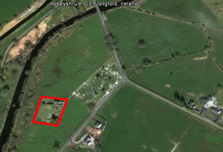
abbey was situated on the side of the River Inny, four and a half miles
east north-east of Ballymahon, on the borders of Longford and Westmeath.
The official Latin name was derived from the location of the abbey: ‘Flumen
Dei’, the river of the god. By the later Middles Ages the abbey was
completely under the control of the Ferrall family. When Abbot Gilbert
died in 1430 Kenan O’Ferrall unlawfully took possession of the abbey and
was to be removed. However, Kenan was still abbot in 1455 when he was
accused of misrule by a monk of St. Anastasius.
There are no surviving sources concerning the revenue of
the abbey, but it is reasonable to assume that Abbeyshrule was never
prosperous. In 1476 it was recorded that the abbey had been burnt by
English forces, although we do not know the extent of the damage. In
1540-1 it was reported that ‘long before the dissolution’ the goods and
of the monastery had been carried off and consumed by the O’Ferralls. It
is thought that, even if monastic life had survived until 1540, it is
unlikely that it continued beyond this date. In 1569 the site and
possessions were granted to Robert Dillon and the abbey was officially
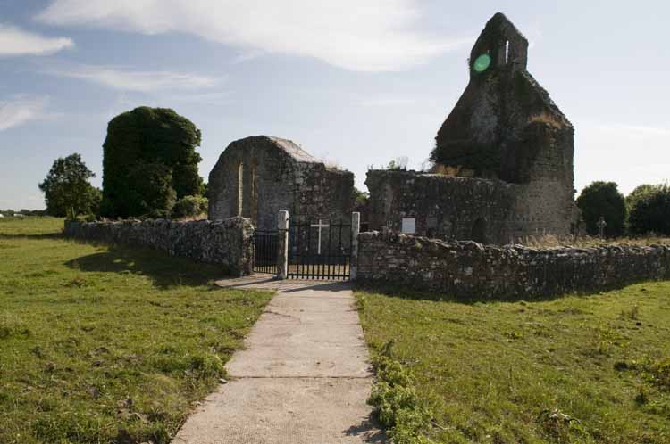
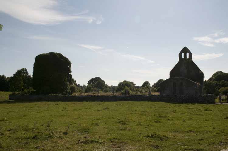
suppressed by Queen Elizabeth in 1592. The abbey church survives
relatively intact but all the other monastic buildings have vanished.
From Google Earth it is possible to outlines of what might have been the
monastic buildings as well as medieval ploughing. The church, parts of which date back to the 13th century, is
now covered in vegetation although a local group does plan to renovate
the tower.
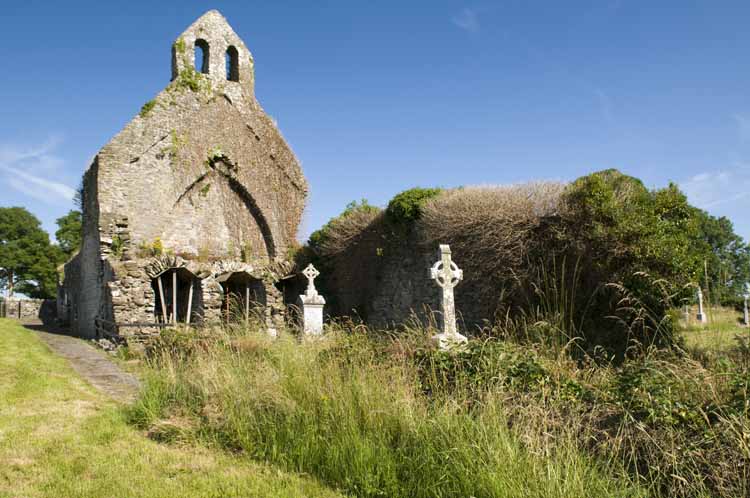
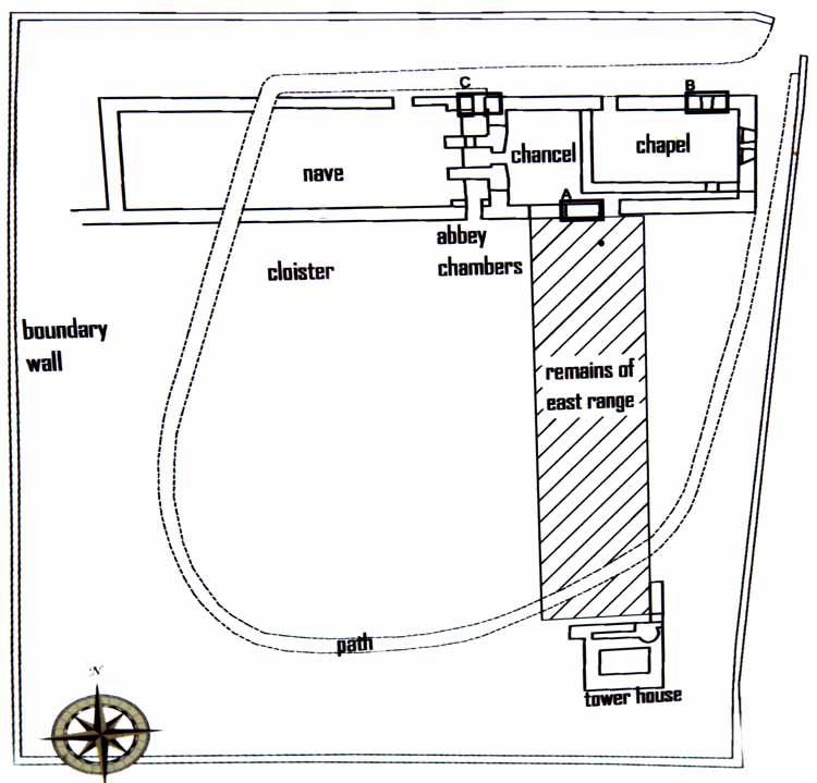
The remaining structure shows evidence of three distinct
phases of construction. Initially an aisle-less church was built, the
east and north walls still partially exists, and the remains of a
cloister arcade can be found as well as part of the crossing tower.
During the 15th century the church was enhanced; the crossing tower's
arch was blocked and three barrel vaulted chapels were added to the
tower's western end and a door in the tower's southern wall led into
what had been the cloister. The discovery of bones and skulls outside
the east wall of the church has led to unsupported tales of the monks
being slaughtered. During the 17th century, or possible slightly later,
the presbytery was converted into a small parish church. The abbey
church, as is common in Ireland, was and is used as a Catholic
graveyard. The only other ruins are of a post-Reformation
tower house which stands approximately 100 feet to the south of the
church and which is totally invisible under a layer of dense ivy. It
originally had four floors which were accessed by a spiral staircase. It
was probably built after the dissolution in the late 16th century.
Plan of the abbey church:
Sources:
Google Earth
Stalley, R. 1987. The Cistercian Monasteries of Ireland, London: Yale
University Press.
University of Sheffield - The Cistercians in Yorkshire Project